
Tracing a Marblehead Street by Address
A Marblehead street search begins with the physical parcel, then follows the records that use that same place in different ways. Marblehead Patriot Properties provides the Marblehead assessment layer. Marblehead AxisGIS supplies the parcel geography. Salem Deeds connects Marblehead land transactions to grantors, grantees, plans, and legal descriptions. A Marblehead municipal voter-file request and a criss-cross directory can add carefully limited person or household evidence for the appropriate period.
Work one Marblehead address at a time and record the exact form returned by each Marblehead source. A Marblehead street number can be absent from an older deed, a historical listing can use a different abbreviation, and a tax mailing address can differ from the parcel's situs. The Marblehead street directory method is a chain of checks, not a single name result.
- Enter the address or street in Marblehead Patriot Properties and save the parcel ID, location, owner, and Book Page shown by the result.
- Open Marblehead AxisGIS, locate the same parcel, and follow the visible lot lines along the block.
- Use the Book Page, owner, or address in the Southern Essex Registry address search, then read the recorded instrument.
- For registered-voter information, use the individual state status process or ask the Town Clerk about a lawful municipal-file request.
- For a past address, search the historical street or householder section of a directory and compare the result with a deed, map, or newspaper.
Note: A deed or assessed-owner result identifies a land-record relationship, not every person who may be connected to the address.
Marblehead Street Directory Fields in Patriot
The Marblehead Patriot Properties portal is the principal street-directory starting point. Live Marblehead result evidence supports owner-name, street, neighborhood, and parcel-detail modes. A Marblehead street result lists one row per returned parcel and can show Parcel ID, Location, Owner, Built, Type, Total Value, Beds, Baths, lot size, finished area, LUC, Description, Neighborhood, Sale date, Sale price, and Book Page.
| Field or mode | Evidence in Marblehead results | Street-directory use |
|---|---|---|
| Street search | Street result URLs and sortable results | Review every returned parcel on a named street |
| Owner name | Visible owner column | Find the assessed owner before deed research |
| Neighborhood | Visible neighborhood column | Compare a grouped area without treating it as a roster |
| Parcel ID | Visible result field and detail link | Connect assessment data to map and office records |
| Book Page | Visible result field | Cross-check against a Registry instrument |
The Patriot Properties property-search screen below is the recorded manifest capture for the Marblehead street directory route.
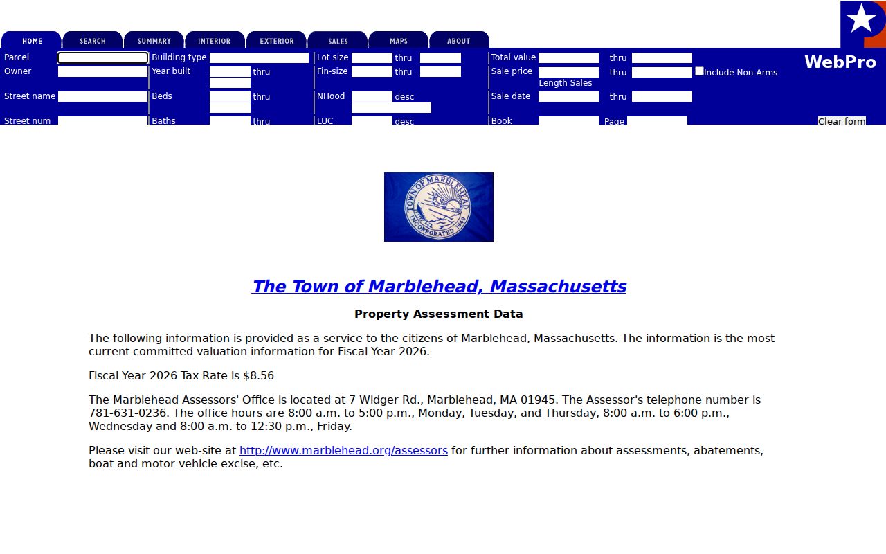
The captured Marblehead street-result evidence includes Book Page, sale date, and sale price. A Marblehead mailing address was not visible in that captured result, so confirm it through parcel detail or the Assessor instead of presuming it appears in every Marblehead street query.
Marblehead Parcels Shape a Street Block
Marblehead Patriot shows an assessment row; Marblehead AxisGIS supplies the map context. Zoom or search to the Marblehead street segment, select the parcel, and use its linked property reference. Then move one Marblehead parcel at a time along the lot lines. The Marblehead Town Engineer also maintains assessor, abutter, zoning, survey, and flood-map references when an online screen cannot answer a parcel-geography question.
Marblehead AxisGIS can establish adjacency and map context, not a complete resident list. A Marblehead town-owned parcel, an entity-owned parcel, or an irregular lot needs a follow-up through the Registry or the responsible Town department. Exact current layer and selection-control labels were not verified in the research, so no unconfirmed map-control claim belongs in a Marblehead street search.
Marblehead's Town Engineer is the practical fallback for an abutter map, flood-panel reference, or engineering map that is not visible in a Marblehead AxisGIS view. The mapped relationship can identify nearby parcels, but only the linked assessment or recorded-land source identifies what the public record actually says about each parcel.
Marblehead Addresses Need Three Keys
Marblehead street-directory results become more accurate when the property terms are kept separate. A Marblehead parcel card can use the physical location, a tax correspondence field, and a land description that do not match word for word. Old Marblehead documents often rely on the legal description or plan rather than a modern street number.
- Parcel
- An Assessor's unit of land, usually identified by a parcel ID in the assessment record.
- Situs address
- The physical location of the parcel, which may differ from the mailing address used for tax correspondence.
- Plat or plan
- A recorded map reference that locates land when the address is missing or changed.
- Criss-cross directory
- A historical street or householder listing arranged by address rather than surname.
Use the location field for the Marblehead street directory, the parcel ID for assessment and map work, and the legal description or plan for a deed-chain gap. None of those keys should be silently substituted for the others.
Note: Marblehead parcel records can carry different address forms, so compare the Marblehead situs, mailing, and legal-description fields before treating a match as final.
Marblehead Street Records by Address
Each Marblehead address-keyed record set has a narrow role. The Marblehead assessment roll supports current property research, the Marblehead GIS viewer supplies parcel relationships, the Registry records Marblehead land instruments, and Viewpoint adds a permit and inspection layer. Marblehead historical directories and Sanborn maps help with dated street context. The coverage table keeps those distinctions visible.
| Address record | Marblehead keeper | What it contributes | Access path |
|---|---|---|---|
| Assessment roll | Assessors Office | Owner, location, parcel, value, sale reference | Patriot portal, counter listing, office request |
| Parcel map | Town Engineer / GIS | Lot lines, adjacent parcels, enabled map layers | AxisGIS and engineering office |
| Recorded land | Southern Essex Registry | Grantor, grantee, instrument, legal description | Address, name, plan, and book/page searches |
| Voter file | Town Clerk / Elections | Permitted voter fields | Individual status route or local request |
| Permits and inspections | Building Inspection | Address-tied project and inspection material | Viewpoint or file-review appointment |
| Historical directories | Library and directory repositories | Dated occupants, businesses, and street entries | Scans, library access, and collections |
| Sanborn maps | Library and map collections | Historic footprints and street geometry | Local plans and map holdings |
Link the records through the parcel ID, location, plan reference, and documented date. A street name alone can be too broad, especially where a record's address field is absent or a historical document uses a different form.
Marblehead Deeds Follow Street Owners
The Southern Essex recorded-land address search requires Street Name, From date, Through date, and City/Town, while the Marblehead street number is optional. Related Registry modes include grantor or grantee name, date and document type, book and page, registered-land owner, certificate or document number, and plan searches. Marblehead belongs to Essex South, and the Registry reports Marblehead holdings from 1640 to the present.
After locating an instrument, capture the grantor, grantee, recording date, document type, book/page or document number, legal description, plan reference, and image availability. Search the grantee as a prior grantor to move backward, or the grantor as a later grantee to move forward. If a street search fails, try the owner, plan, lot, neighboring owner, or book/page instead.
Note: A deed transfers an interest in land and does not independently prove that a named party occupied the Marblehead address.
Marblehead Permits Date a Street
Building and inspection files add a construction and change-date layer to a Marblehead street directory search. The Town of Marblehead moved to Viewpoint Cloud for online permitting around spring 2020. The Marblehead annual reports describe public visibility for planning, zoning, building, fire, electrical, plumbing, inspections, complaints, fees, and monetary information, subject to the record shown.
The live Viewpoint interface returned a 403 response during research, so unverified search fields are not presented as facts. The documented fallback is a file-review appointment with Building Inspection at 781-631-2220, or a focused Town public-records request. A permit can identify work or an applicant role; it is not a substitute for an assessed-owner or resident record.
Marblehead Voter Files Have Limits
Massachusetts does not provide a public web map of all registered voters along a Marblehead street. The state process lets a person check an individual status. A full municipal paper or electronic voter file is requested from Marblehead Elections. Public fields can include name, residence address, party, date of birth, active or inactive status, voter ID, registration date, prior changes, and election participation as the rules permit.
Telephone, email, confidential-voter information, and minors' records are not public. A result cannot establish every person at an address. Contact Marblehead Elections for the proper local-file procedure, and use the state voter-status instructions for an individual's own registration path.
Marblehead Street History Needs More Keys
A street number is only one historical key. A place may also appear as a parcel, legal bounds, plan or lot, Sanborn footprint, neighborhood, ZIP, business address, directory entry, or adjacent owner. Marblehead's historic streets and varied neighborhood development make it important to change keys when a modern address returns no older result.
The research did not verify a universal Marblehead renumbering schedule. Use an old street name, adjacent owner, business name, occupation, plan, map year, or deed book/page as a bridge instead. This is often stronger than forcing a current number into an old directory or land record. It also limits false matches between separate places that happen to share a street name.
Marblehead Criss-Cross Street Listings
Reverse or criss-cross directories are the historical complement to current parcel work. In a Salem-area volume, read the street or householder section for an address, then return to the alphabetical listing for any occupation or business detail supplied by that run. Marblehead appears in combined Salem-area volumes even when the cover does not place Marblehead first.
Search surname variants, initials, abbreviated street names, and nearby directory years. A listing can reflect a person, business, institution, or mail recipient, so compare it with a newspaper, map, vital source, or deed. The collection years and scan routes are covered in the Marblehead city directories.
Note: A Marblehead street listing is a dated directory clue and needs another Marblehead record before it supports a conclusion about a current address.
Marblehead Street Directory Privacy Limits
A Marblehead street directory cannot provide every household member, utility customer, motor-vehicle address, protected voter, or person whose record is restricted. Assessment fields may identify an owner but not an occupant. A tax mailing field is not proof of presence at the parcel. Court, vital, and election records have separate privacy and access rules.
Massachusetts Address Confidentiality Program participants and other protected people may use substitute or withheld address information. A missing record should prompt a check of the responsible custodian, not an attempt to infer private contact or location data.
Marblehead Street Search Fallbacks
A failed portal search does not end the street-directory trail. The Assessor can confirm parcel-detail availability, the Town Engineer can help with abutter or map material, the Registry accepts written public-records requests, Building Inspection offers file-review appointments, and Abbot Library supplies historical maps and directories. A defined request should state the address, record type, date range, and preferred format.
Registry navigation changed in April 2026, when a new search module was introduced while the classic search remained under Searches. Check both search paths before concluding an address is absent. For Town-held material outside a public screen, use the Marblehead public-records request form and confirm any estimate or access condition with the custodian.